Trip Report for Duckabush River
 Where: The Brothers Wilderness, Olympic NF
When: Wednesday, November 19, 2014
Stats: 6.6 miles round trip – 2,300 foot elevation gain
This is the first hike since Mount Zion back in March that I have done alone. Justin was to have joined me, but an injury to his foot forced him to back out at the last minute. I thought, at first, that I would stay home and not go hiking as a result, but then I got to thinking. I was already dressed, my pack was packed, and I was jittering around the apartment at 6:30 am. What the hell? I decided to go hiking.
I had missed the intended 6:20 ferry but had no trouble getting down to the ferry terminal in plenty of time for the 7:10 sailing. From Kingston to Quilcene the drive was one I’ve done three or four times this year, and the rest of the drive down to Brinnon and on to the trailhead was one I’ve done once before, back when I hiked Ranger Hole and Murhut Falls with Joel. Along the way I pulled over to the side of the road to enjoy and photograph a beautiful sunrise.
Up at the trailhead I found that I had the place completely to myself, which wasn’t too surprising for 9:00 am on a Wednesday morning in November. I didn’t expect this to be the case throughout the rest of the day, but as it happened I didn’t see another person at all on the trail all day long. Time to get my boots on the loam.
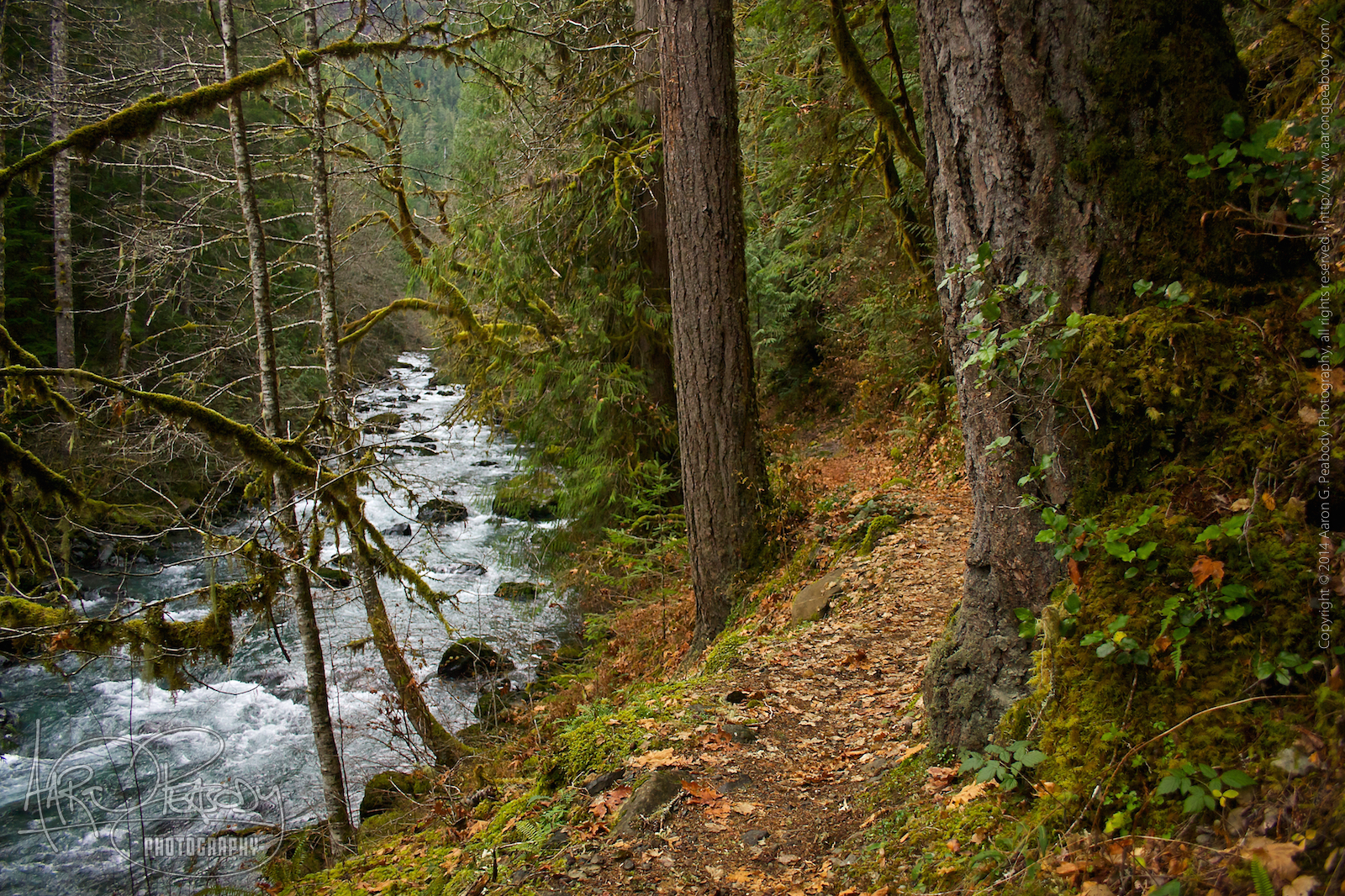
My trail book describes the Duckabush River as your constant companion on this hike and it was, but not at first as something you can see. The river is fairly audible, though, even when you can’t see him at all. The first section of the trail was a pretty steady ascent up a geographic feature called Little Hump (I bet you can see where this is going). It wasn’t a challenging grade but it is a fairly long one. Every hike, even easy ones, is a challenge in one respect or another. Even when it’s just a long walk up a hill there are roots and rocks, and because it’s been a few weeks since the last time you can still get out of breath and feel the stiffness in your leg muscles.
Little Hump was crested with little fanfare, and the only reason you know you’ve done so is because the trail starts downward. The descent on the other side is steeper, but also shorter and soon you bottom out. On the slopes the forest was fairly dense and pretty typical of the eastern Olympics. Now, down at the bottom, things began to change. For one the trail entered about a mile stretch of being practically flat as it would through the forest. Here I was walking through the bottom land often associated with rivers. I have a hard time believing that this flat area ever flooded, but any flat land near a river seems to have a somewhat similar character to it. The trees are a bit more open. The undergrowth is more lush. It was during this section of the hike that I crossed a number of small streams and the first dry bed of what looked like it could be a pretty significant stream to the river off to the south. The rocky bed cut across the trail, perhaps five or six feet wide, and I could tell from the height of the banks that the water flow could be as deep as mid-calf and fairly swift. I imagine its quite the thing to cross in the spring.
Continuing on the trail eventually began to climb a little bit and soon the river came into view for the first time. The trail was up a bit of a slope from the river, perhaps eight or nine feet above it as it wound around trees and rocks. Eventually it descended down to a small clearing where I imagine folks sometimes camp. At this point I was nearly down at the level of the river and was able to walk out on a rocky shelf right to the water’s edge. The river was about twenty feet wide at this point and, looking down into the water, I could see places no more than a foot from the shore where it would be up over my shoulders if I were to stand in it. Not that I could, of course. That volume of water moving at that velocity would have knocked me right off me feet and dashed me against the plentiful rocks.
After a little while spent noodling around here I started up the next section of the trail. At this point my ascent of Big Hump began. Unlike the ascent of Little Hump this one was not a moderate slope, but was instead a series of sweeping switchbacks. Looking back I regret that I didn’t take any pictures along this part of the hike. Back in 2011 a fire swept through this part of The Brothers Wilderness, leaving many of the trees with charred and blackened sections to their trunks. In fact, many of them showed signs of the directionality of the fire, being burned only one one side. It was quite the landscape. It was really great to see the many signs of a forest revitalized, too, so I’m glad they did the responsible thing and let it burn.
Nearing the top of Big Hump I came upon something remarkably cool—a raining rock wall. There must have been a small stream or a spring up at its top, but instead of flowing down in one path the shape of the rock and presence of a lot of moss defused the flow on such a way as to make the whole wall rain. It was really neat to see and I’m sorry I didn’t have my iPhone with me to capture some video of it.
A bit further up I came upon a rocky shelf jutting out from the side of Big Hump. It looked like a nice place to rest but I wanted to push on to the top, so I continued upward. I think I made it just about to the top, but had to finally turn around. There were a huge number of pretty large trees fallen across the trail. I had been clearing some smaller obstructions as I went, while going around, over, and under the larger ones, but at this point it looked like there was no end in sight. I turned my feet back around and headed back to that ledge I had seen. I spent a nice long time here, having some lunch, and taking a lot of photos (as you’ll see). For a while I just lay on the moss, looking up at the sky, and enjoying the sound and feeling of being completely alone.
As I made my way back down the trail afterward I stopped to take a few pictures at another rock-bedded yet dry stream bed that crossed the trail. This one, based on the available evidence, would probably have been up over knee deep at full spring flow, and was easily ten or twelve feet across. That would be a definite challenge in a springtime hike.
I moved along, taking a few more pictures near the river, and powering along the flat space between the Humps. Huffing and puffing I climbed the steeper side of Little Hump and then swung down along the gentler side, all the way back down to the trailhead where my car was still alone in the parking lot. From there I made my way back to Kingston and a quiet ferry ride home.
Leave a Reply