Trip Report for Deception Pass
 Where: Deception Pass State Park, Fidalgo Island
When: Friday, November 7, 2014
Stats: 5.0 miles round trip – 350 foot elevation gain
This was to be our second go at using Meetup.com to attract a larger group of people and to meet some new folks, and for a while it looked like we were going to be very successful. At one point about two weeks ago we had almost 30 people signed up for this outing. By the time the morning of the seventh rolled around that number was down to less than ten. Justin and I met up around 8:00 and then headed up to the Mountlake Terrace Transit Center to wait for the folks who still said they were coming. We got there around 8:20 and waited until 9:00. No one showed up. We were pretty disappointed, but certainly didn’t let it stop us from intending to enjoy our day.
In a meteorological repeat of what happened for the Mount Pilchuck hike, over a week of wet weather broke the night before our planned excursion and we found ourselves possessed of a pleasant day. Unlike Pilchuck, where the day was still chilly and overcast, Deception Pass basked beneath sunshine, blue skies, and relatively warm temperatures. We really couldn’t have asked for better conditions, which makes it even more of a shame that so many people failed to show up. Traffic was light and we made very good time, reaching the trailhead at about 10:30. At the State Park we were in for a rude surprise: the price of a day parking pass had gone from $5 up to $10. The difficultly lay not so much in the increased price as it did in us not having that much cash on us. We decided to risk the possible fine, rather than driving back up to Anacortes to find an ATM.
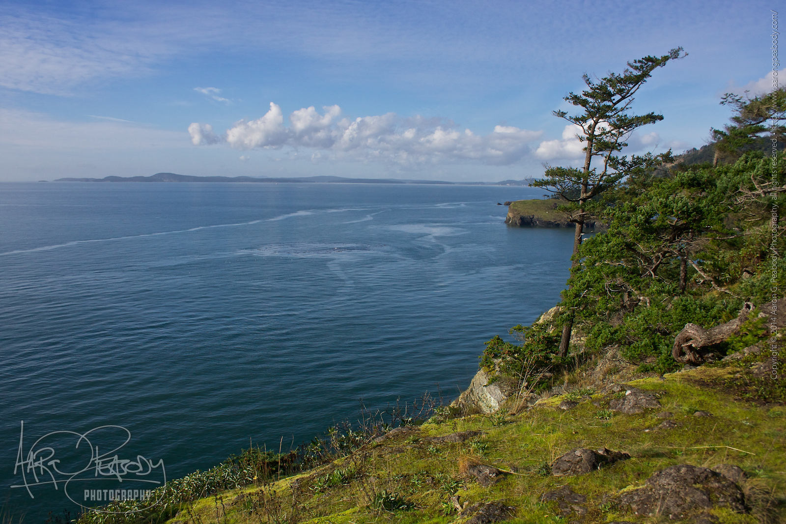
There are a couple of trails that lead off of the parking lot. We decided to head south initially, taking on the longer and more difficult bit first. We first looped around the point above Lottie Bay, getting a couple of nice views of the Pass south of us, though nothing spectacular. That bit of land is pretty heavily forested, lacking the open spaces that promote broader views. We followed a small loop around and then returned to the junction which lead us next to Lighthouse Point. After a short descent through the woods we strolled across the north side of the narrow spit of stony beach separating Lottie and Bowman Bays. The sand was dark grey and very, very fine. It formed a dense matrix that was very easy to walk across. There was a thick covering of brilliant green seaweed all along the high-water line. It was super squishy to walk across, causing us to sink up to our ankles again and again.
Across the spit we climbed up Lighthouse Point, quickly arriving at a small overlook where we sat on some comfortable rocks and had a snack. We continued our trek around the south side, at one time crossing over to a rocky outcropping divided from the main body of land. Up there we had some nice views of the Pass and the land around us. From there we continued along the shore, climbing up to the high point on the western side. As we walked along the trail we saw a strange motion in the water. Looking at it we figured out that there was some kind of current that, combined with the sub-surface rocks, created a weird shape to the waves. As we looked at that we also got to looking at the tall point of rock across a little spit from us. All of a sudden we saw that there was a long piece of rope hanging down inside a cleft in the rock. Could it be possible that it was scalable? We scrambled down the steep slope on our side of the cliff, walked across the rocks, and got a closer look at the far cliff and the rope.
At this point the sensible thing for us to do would have been to turn around and climb back up the way we came. We had no way of knowing how strong the rope was, what it was anchored to, or whether the cliff itself would hold together. Being sensible, adult males we naturally decided that we had to give it a shot. I went first, hauling myself up, hand by hand, feet against the wall. There were a couple of tricky spots, and the plastic of the rope was tough on my bare hands, but I made it to the top just fine. Turns out the rope was tied around a tree root. Justin followed me up in short order and we started exploring. There was a contraption out there that we suspect was an automated lighthouse, which caused us to wonder whether this or the larger spot we had just come from was Lighthouse Point. We explored some more and found ourselves able to see the spot below us where the water had been doing those interesting things. From this point we could see that it was a ferocious riptide. We hung out here for a little while, enjoying the sights. We had a really good vantage point on Deception Island, especially through my binoculars. That’s exactly the kind of spot that I’d really like to own some day. Just big enough to build a nice home on, with plenty of privacy, yet pretty close to the amenities of Anacortes. After a bit we made our way back to the rope and rappelled down. I went first, once again. At Justin’s suggestion I looped the rope around my waist, but that didn’t work all that well. Before starting down Justin sent his pack down the rope to me, which was an adventure in and of itself. He followed it down and we climbed back up the other side.
We continued our exploration of this larger Lighthouse Point, eventually making our way along a spur trail to the northern edge. We continued wandering around, eventually ending up on what I think was a game trail. We tried to use it to get back down to Bowman Bay, but figured out, eventually, that we could not. Some backtracking and bushwhacking returned us to the trail and we got ourselves back to the parking lot. We hung out here for a while, taking in some sustenance, before starting on the northern trail to Rosario Head.
This section of the trail is both shorter and easier, a quarter of it being flat and level, cutting across the picnic area. We headed out along the point, stopping to read the story inscribed at the monument there. We wandered along the northern side of the Head, enjoying the sight of the Urchin Rocks amidst the waves, before climbing up to the western side. We strolled around the grassy headlands, watching the sunlight play across the ocean waves. With the sun sinking lower we made our way back to the trailhead and into our car, where we discovered no parking ticket!
We decided to make our return trip down through Whidbey Island, stopping in Coupeville for dinner. Some hot food went nicely with the exertions of the day. It was a good trip in beautiful weather, and though we didn’t see a pod of orcas we did see a bald eagle and—briefly—a seal. Not too bad.
Leave a Reply